Pierce Wanderings
Texas Hiking (and elsewhere)
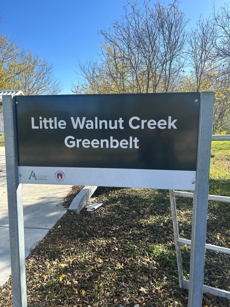
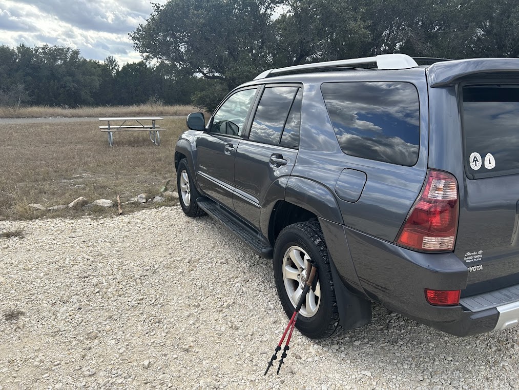
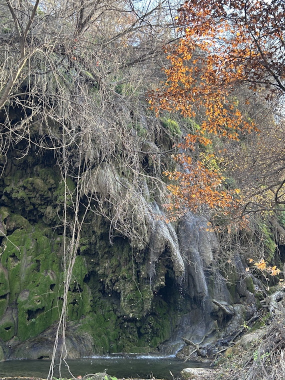
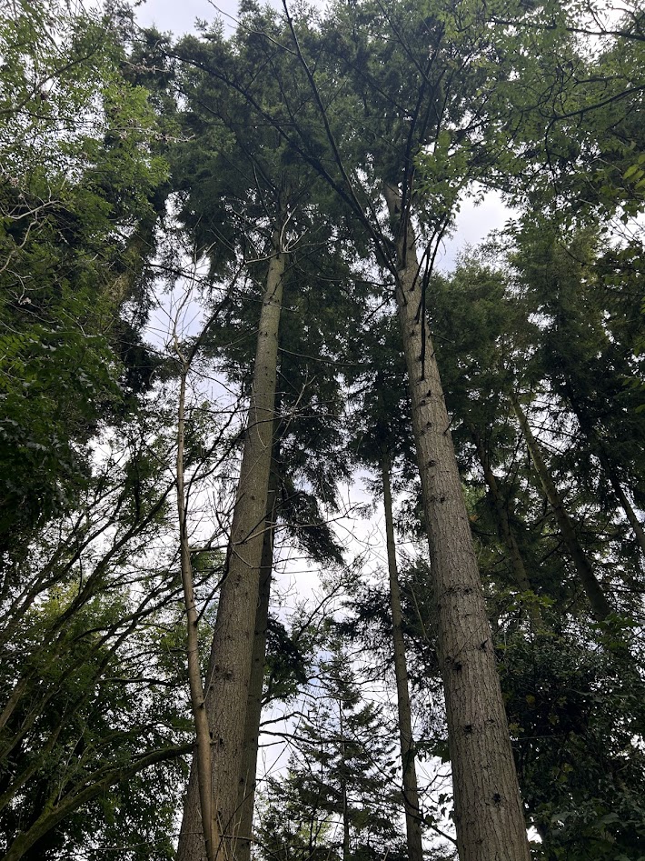
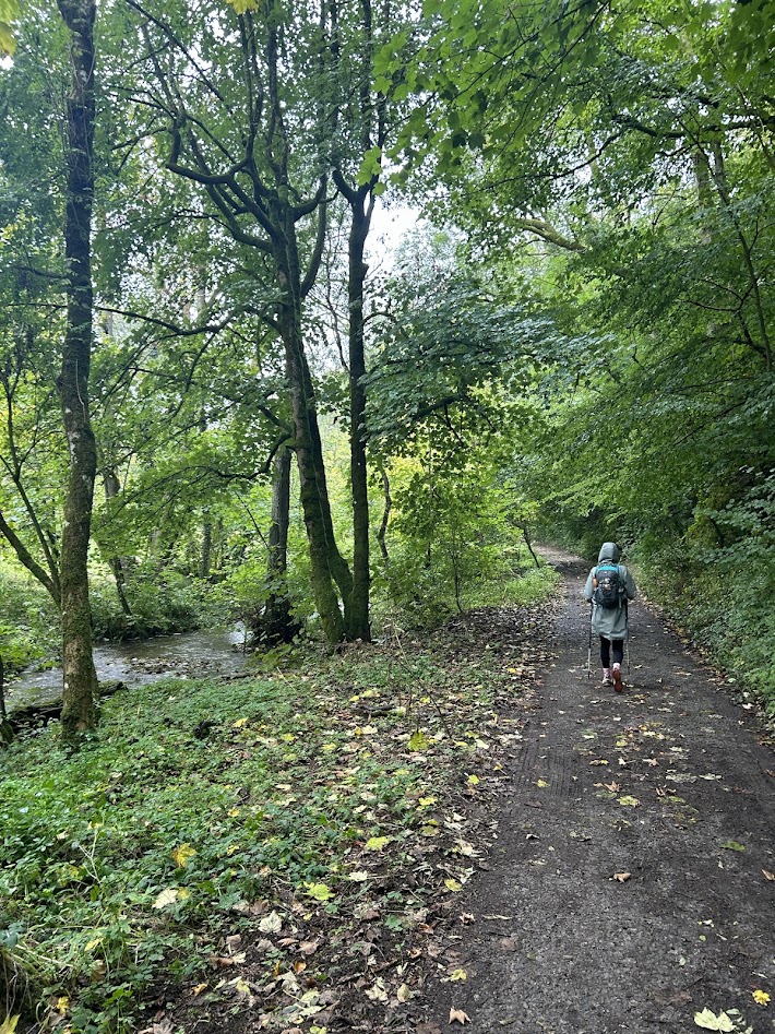
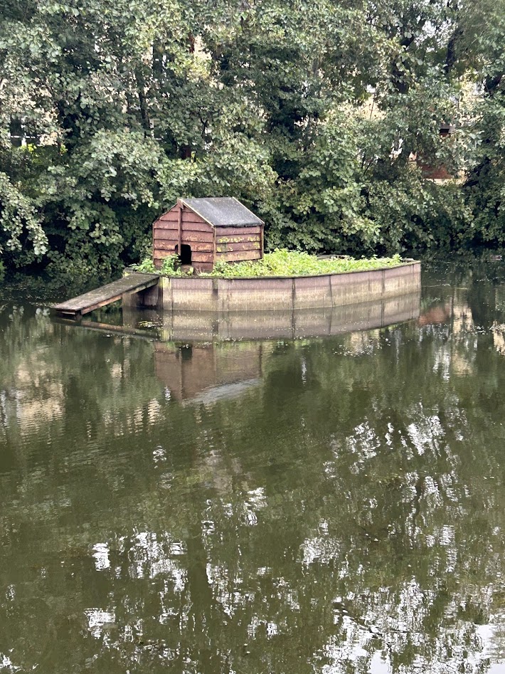
Little Walnut Creek Greenbelt 12/21/25
Sunday, December 21, 2025
Ian, Court, Finn, and Biff
About 2 miles
I’m alive! I haven’t updated this blog in almost a year and that’s ridiculous. I’ve been hiking, though not nearly as much as I should be due to various life circumstances, and I try not to write posts for trails I’ve already done before anymore, but I actually found a new trail system in Austin just down the street from my neighborhood.
From the Austin Parks Department website:
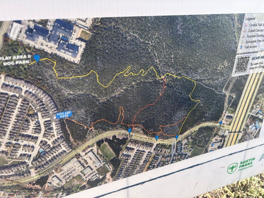
The Little Walnut Creek Greenbelt encompasses 206 acres of hilly, wooded terrain intersected by creeks and ravines near the intersection of 51st Street and US-183 in East Austin. More than four miles of informal trails wind through the property, which previously lacked any major improvements. Portions of the greenbelt, once zoned for commercial and residential use, were rezoned entirely for public use in 2017.
In 2023, Austin Parks Foundation and Austin Parks and Recreation received a grant from Texas Parks and Wildlife to complete approximately two miles of improvements on the existing natural trails at Little Walnut Creek Greenbelt. Texas Conservation Corps completed the first phase of trail work in 2024. The second phase will focus on the southern section of the trail network and will include closing eroded trails to support habitat restoration and improve wayfinding throughout the system. Crews will also work to establish a clear connection from the play area off Springdale Road to the trail connections on 51st Street.
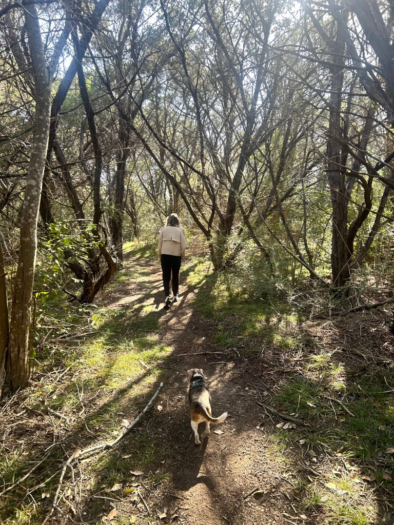
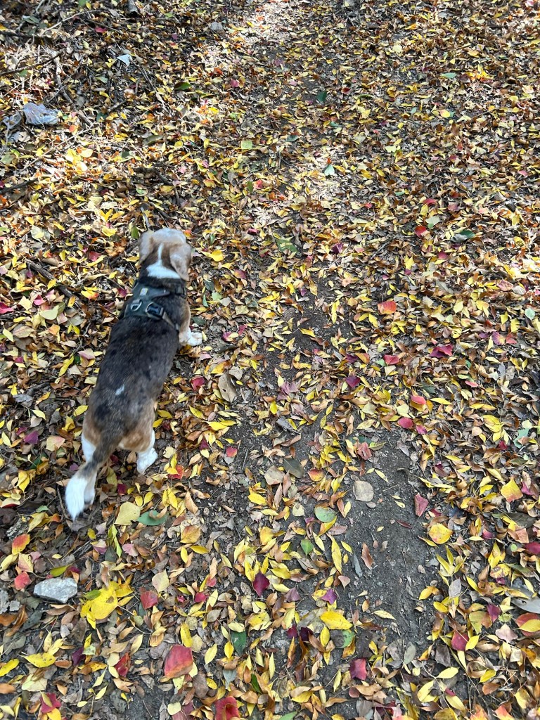
It was a warm day (all of December has been warm so far) and we got a couple of miles in on unexplored trails and ended back at the dog park and playground where we let Finn and Biff play for a while. Looking forward to the continued trail improvements in the coming years!

Kawarau Bridge Bungy Jump – Queenstown, NZ 2/6/25
Thursday, February 6, 2025
I wanted to add this video because it was amazing and was also something that I have wanted to do since I first came to New Zealand when I was 12. I stood on this very bridge back then, but wasn’t able to do it, so 30 years later, I finally completed this milestone.
Now I just need to come back and do the higher one – 3x this height! One day…

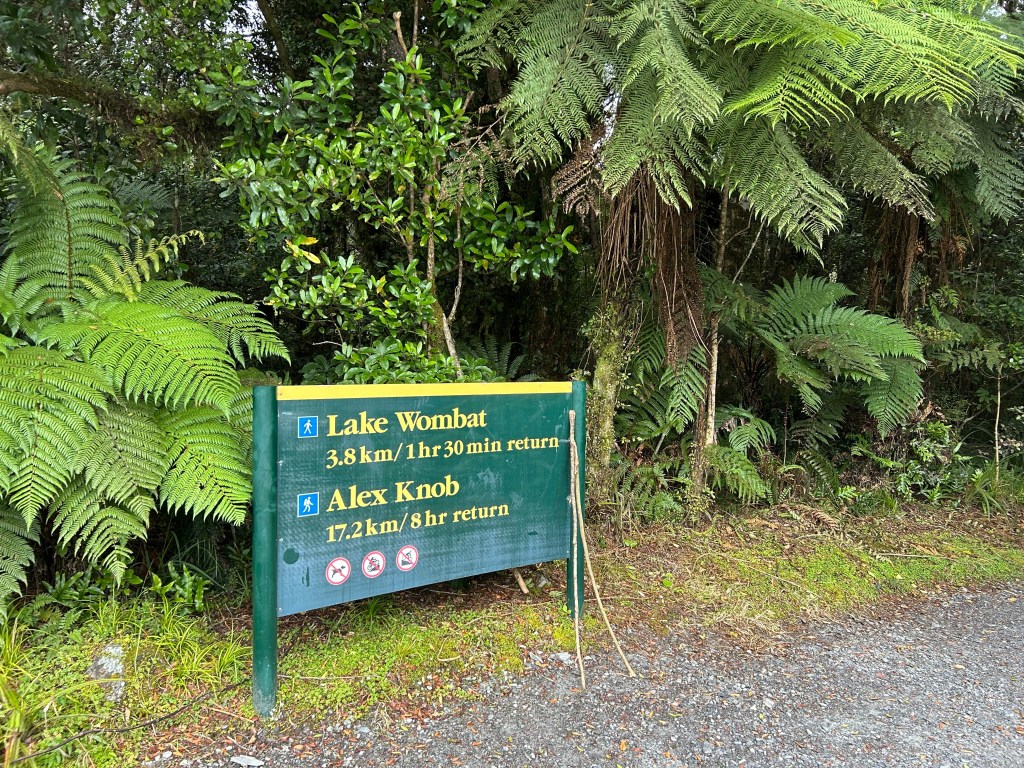
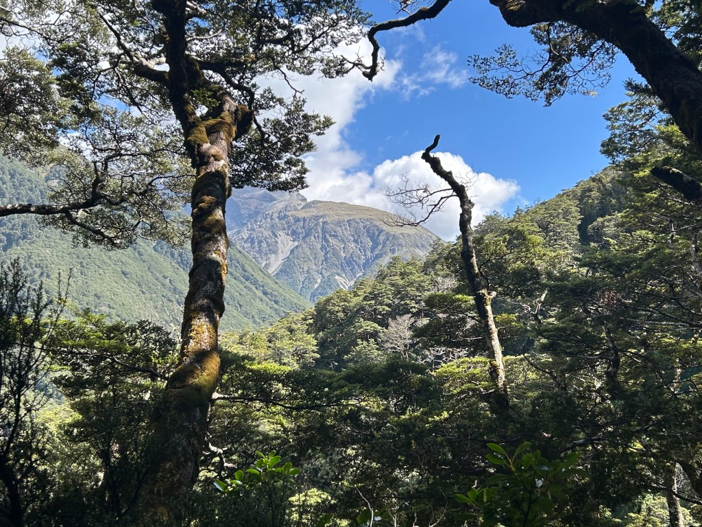
Alex Knob Trail – Franz Josef Glacier, New Zealand 2/3/25
Monday, February 3, 2025
Alex Knob Trail – Franz Josef Glacier
Cloudy, cool, mid 50s
Ian, Court, and Doc
8.09 miles
Franz Josef is a neat town in the valley below the Franz Josef Glacier. It was named after the Austrian emperor in the 1800s. Court also had her favorite meal of the trip here, an Indian restaurant with Jalfrezi.
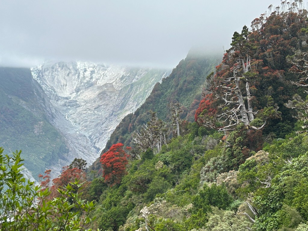
When we woke up for the hike, the clouds were very low and would remain so the entire day. It was very surreal walking through a rainforest to views of a glacier.


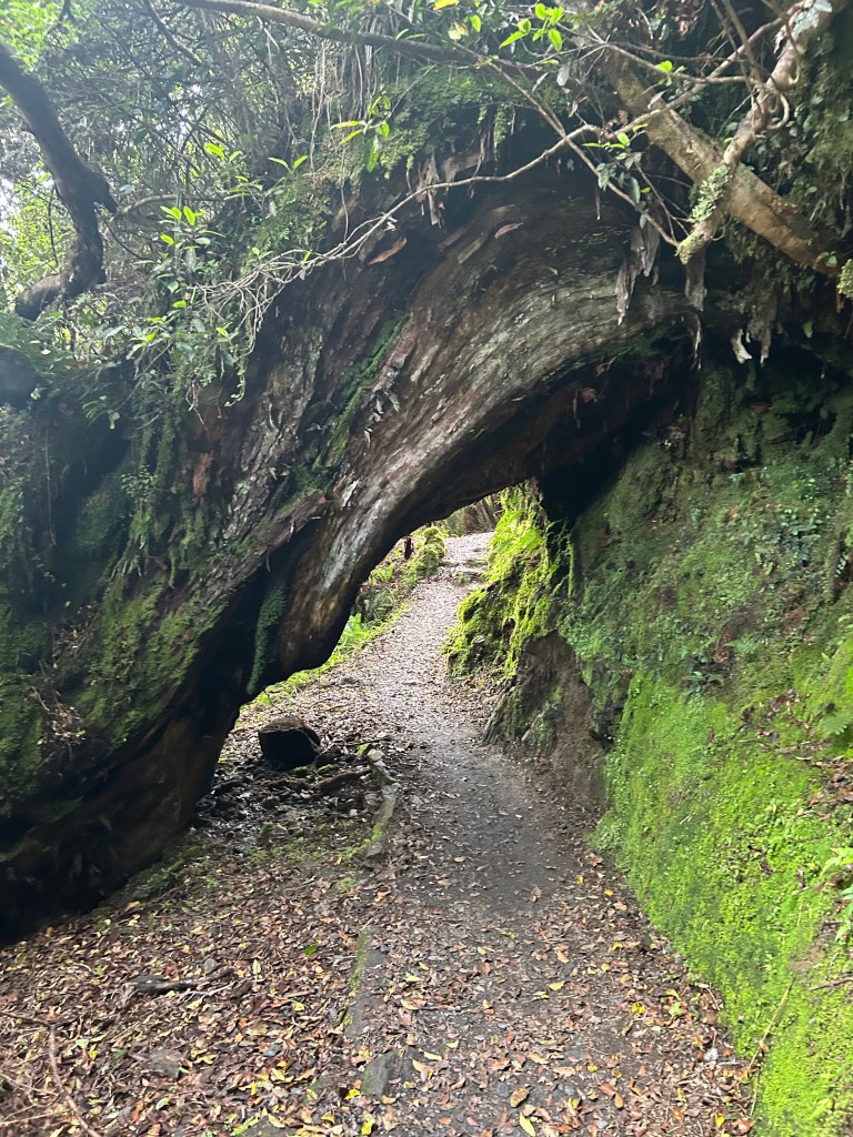
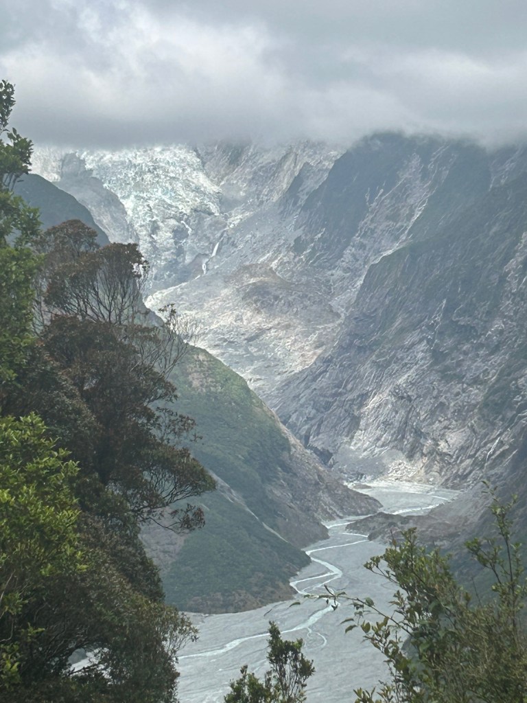
We hit the trail in the morning and started the climb up through the forest. We would stop a bit short of the summit and turn back, but we heard from other hikers that there was no view at the top due to the clouds anyway.
The trail was well maintained at the beginning and would get very rooty and rocky later on. One annoying aspect was the constant stream of tourist helicopters that buzzed our heads the entire time, taking people up to the glacier. There is something to be said for wilderness without the sounds of human interference. There is a great book and research project called One Square Inch of Silence that explains the importance and beauty of quiet spaces that I highly recommend.
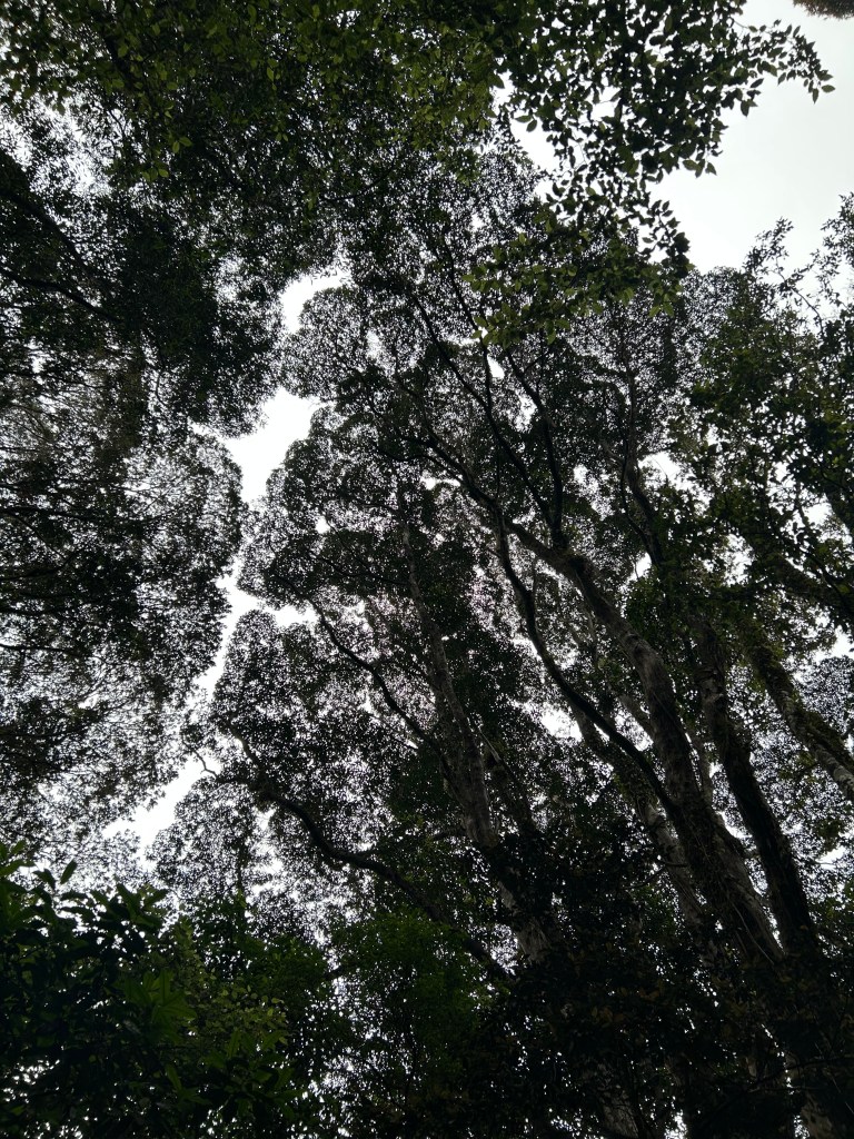


As we climbed up the mountain, the trail became more challenging, but more beautiful.


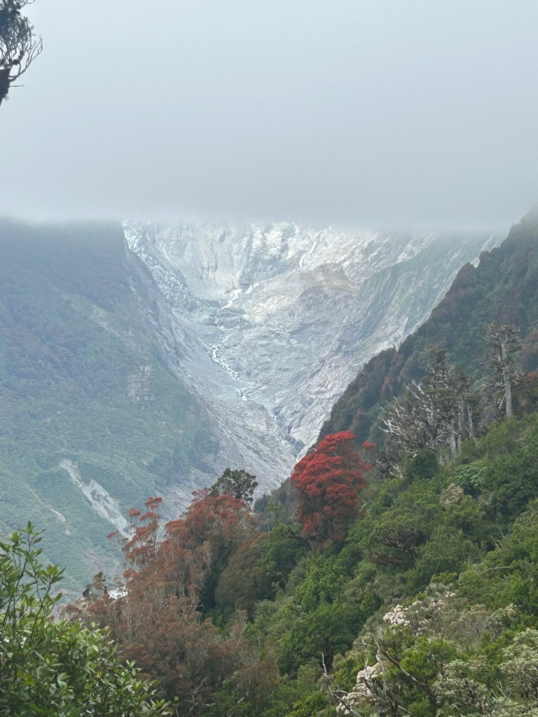
There were all these red filaments on the ground that were from flowers from the trees known as Christmas Trees. I don’t know the real name of them, but it made the forest floor very beautiful, with pops of red everywhere.


A couple of hours later we made it to our turnaround point at Christmas Lookout, again named for the red trees. The view was somewhat obstructed by clouds, but still beautiful.


We headed back down and were excited to go find food at the aforementioned Indian restaurant. I was especially impressed with Doc on this hike, as it was not easy by any means and he made it the whole way without much trouble. Good job everyone!

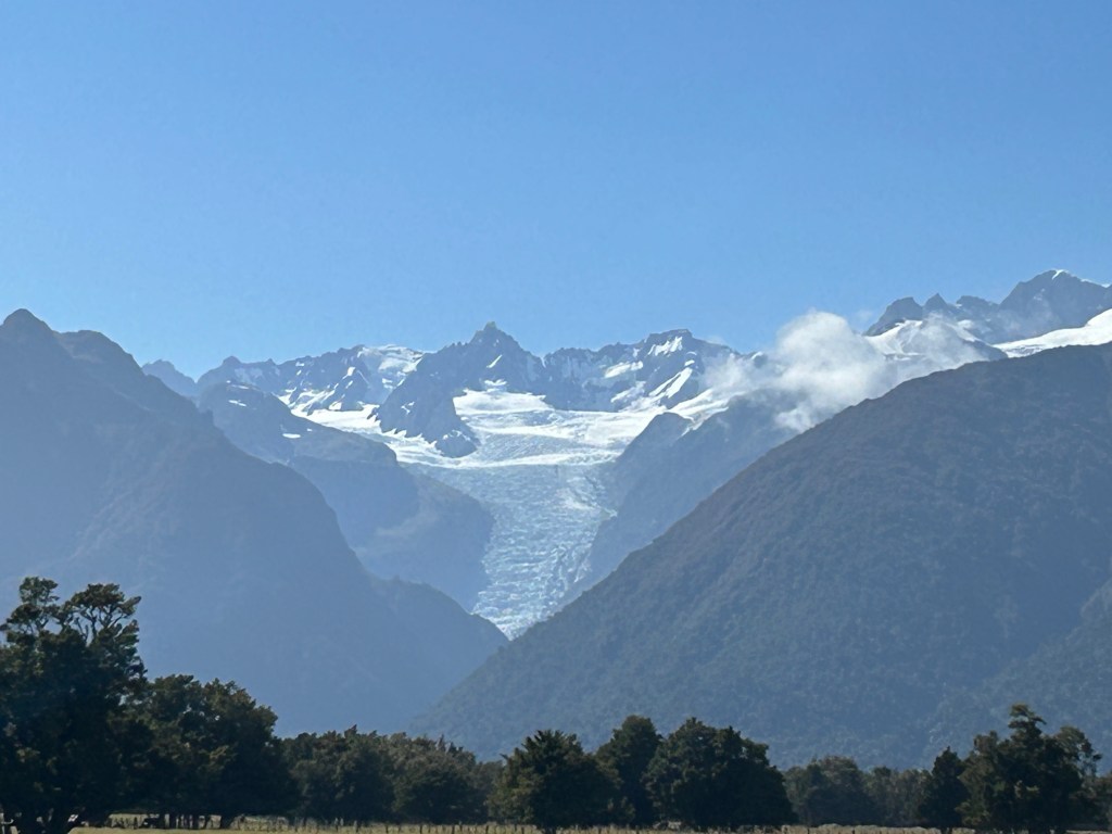
Bonus pics of the Fox Glacier that we took the next day on the way to Queenstown.


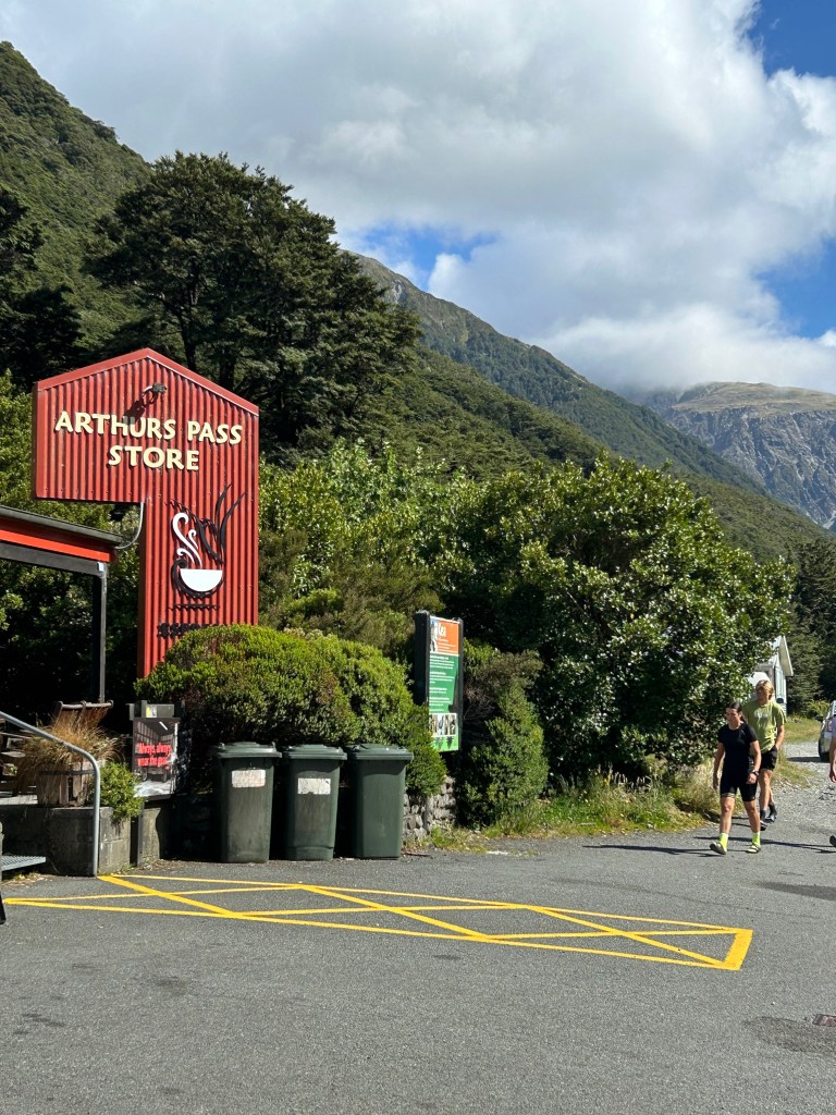
Devil’s Punchbowl Falls – Near Arthur’s Pass – New Zealand South Island 2/2/25
Sunday, February 2, 2025
Devil’s Punchbowl Track to the Falls – Near Arthur’s Pass
Sunny and cool
Ian, Court, and Doc
1.5 miles
On the drive across the South Island from Christchurch to Franz Josef, we did a quick hike up to the falls near Arthur’s Pass, a trail town for the Te Araroa trail, which traverses the length of both islands. We saw a lot of backpackers and also a local Kea that hung around the cafe trying to get people to feed it. They are known as the Clowns of the Mountains in New Zealand and are very smart and very mischievous.


The trail wasn’t long and the falls were beautiful. There were a lot of stairs though.
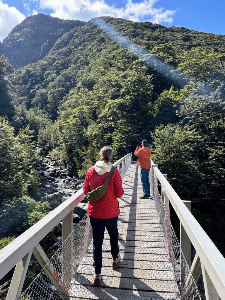

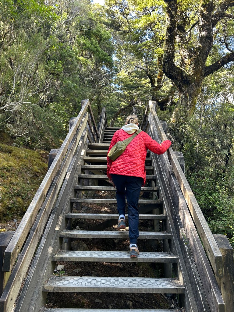


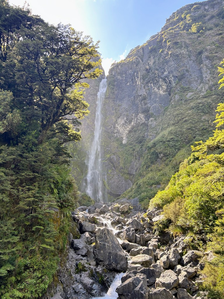
After a nice walk to the falls, we headed on to the west coast of the South Island to Hokitika for a lunch break and then down to Franz Josef where we would have our biggest hike of the trip.

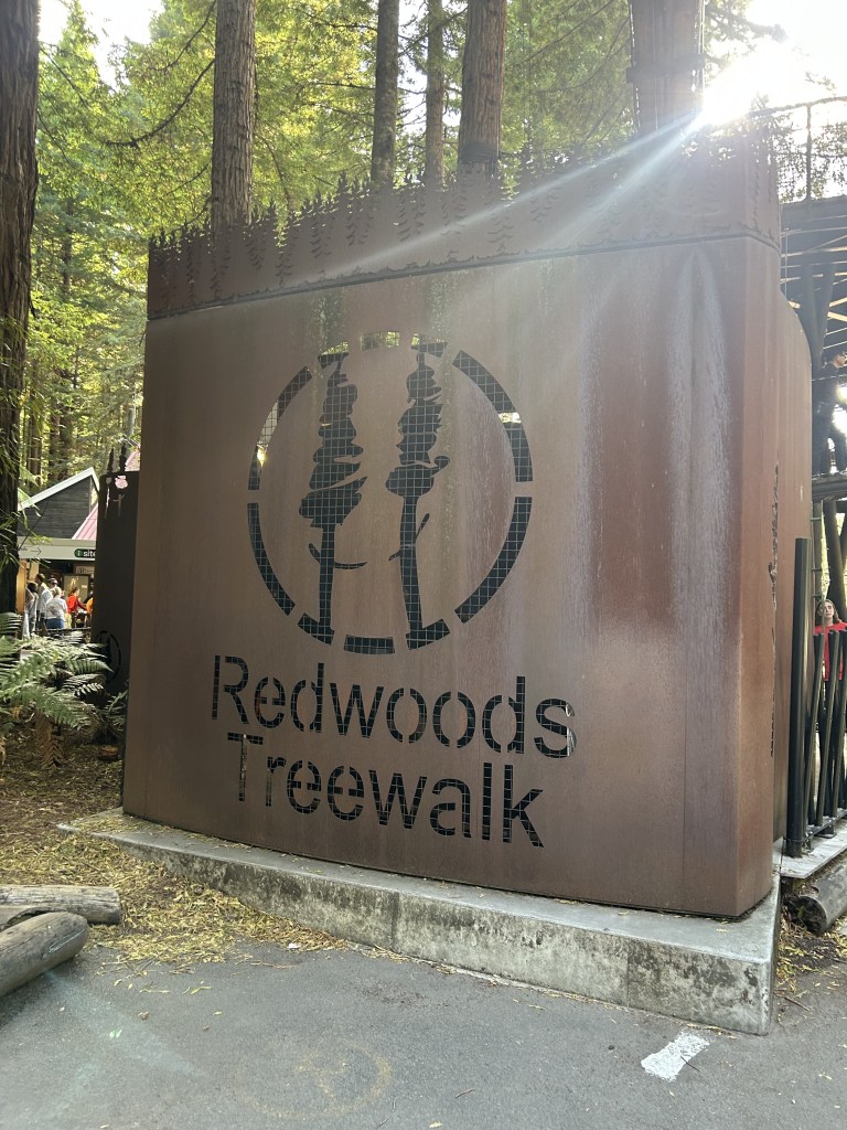
Redwood Tree Walk – Rotorua, New Zealand 1/28/25
Tuesday, January 28, 2025
Redwood Tree Walk
Ian, Court, Doc, Suz
A few hundred yards of suspension bridges
After a long day at Hobbiton (from which I will spare you the nerdery on this blog), we ended with a short and fun walk amongst the trees near Rotorua. These redwoods were imported from America over 100 years ago and thrive in the New Zealand weather.

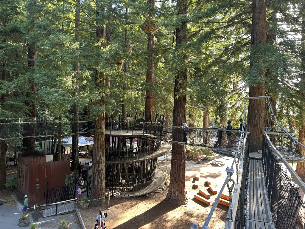

The bridges were very sturdy and only about 30 feet off the ground, so it wasn’t intense, but was very pretty. You can also do this walk at night and there are lights built into the canopy that are made to blend in and become a part of the forest.

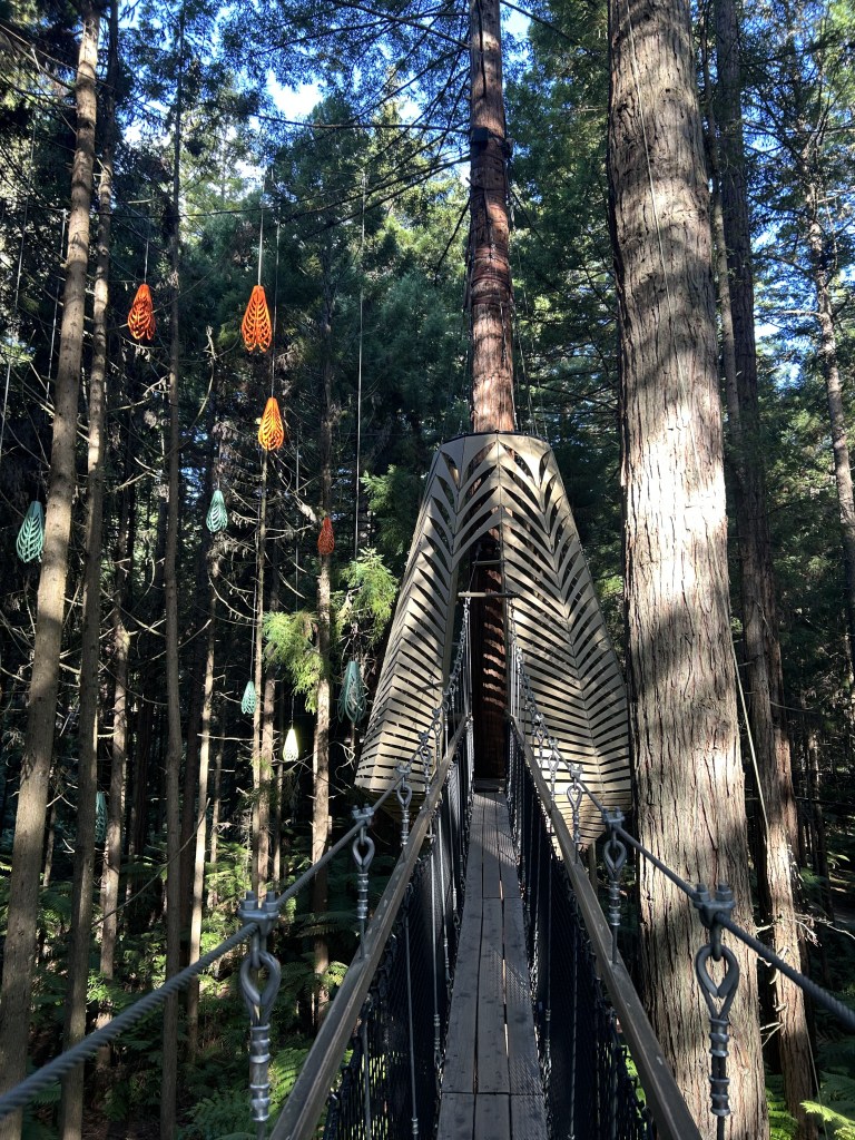


It would have been nice to see the night walk, but we had a two hour drive back to our hotel in Hamilton and I had only been driving on the left side of the road for a couple of days, so I wanted to get back before dark. I would get very good at driving on the left though.
Next: South Island hiking!
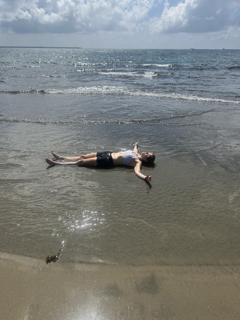
Nanuku Beach to Overlook – Nanuku Resort, Pacific Harbour, Fiji 1/26/25
Sunday, January 26, 2025
Nanuku Beach to Overlook Trail – Nanuku Resort, Pacific Harbour, Fiji
HUMID, mid 80s, HOT
Ian, Court, and Doc
2-ish miles
On the way to New Zealand for a two week vacation, we had a stopover in Fiji for a night and did a quick hike up to an overlook near our resort. The humidity was intense and made it feel at least 10 degrees hotter than the mid 80s. We walked for about half a mile down the beach toward a point with a large hill and then around to the back side of it to try and find the trail.

At first we thought the trail was a myth, but then as we were about to give up we found the opening and a rope tied between the trees going straight up the hill with some earthen steps through the jungle. Without that rope to hang on to, it would have been a tough and slippery climb. The trail was only a few hundred yards and mostly straight up and not very well maintained, but then opened up to a beautiful view of the bay and the beach looking back to the resort.

The sun was blazing and we didn’t stay for long. Once we got back to the beach, Court decided it was time to cool off.
We then walked back down the beach, picking up plastic trash as we went. Sadly, no matter how remote you get on Earth, there is always evidence of man’s influence. It was a pretty hike and we wish we had been able to stay in Fiji more than one night, but it was off to New Zealand the next day.
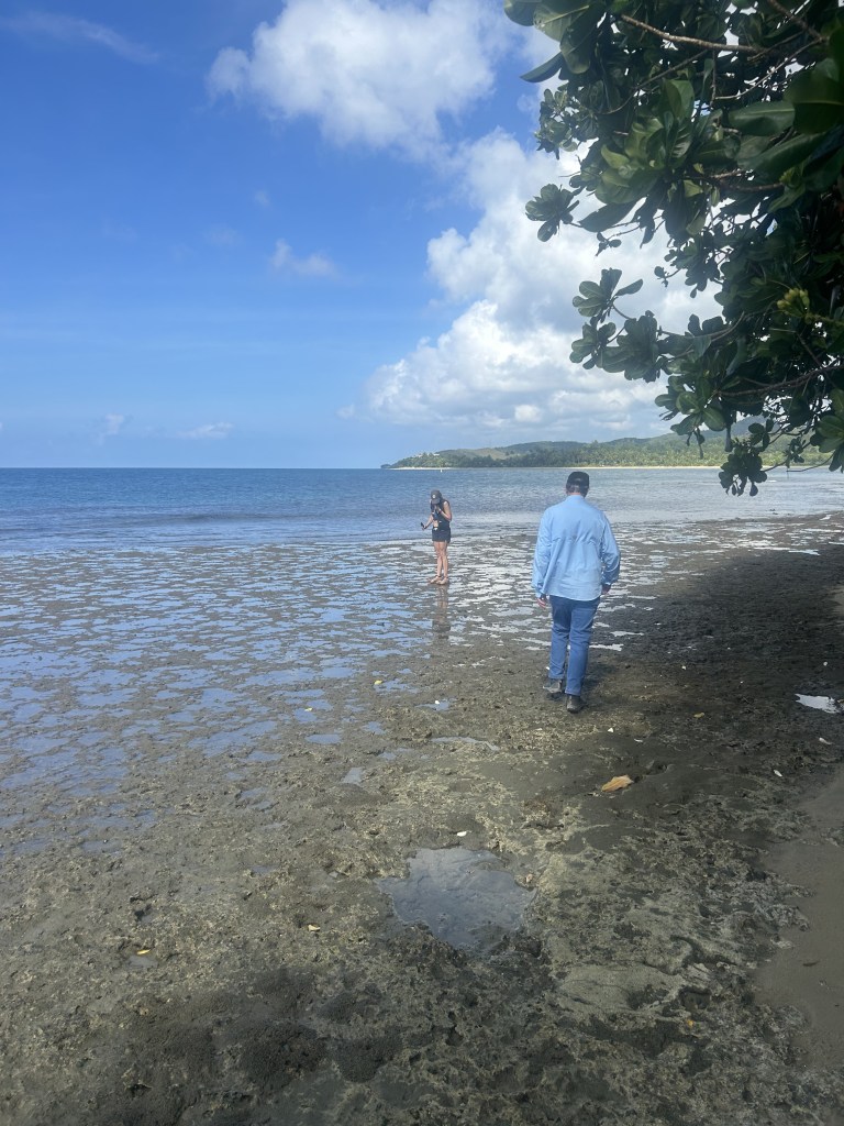
Colorado Bend Overnight 12/17/24-12/18/24
Tuesday-Wednesday, December 17-18, 2024
Ian Solo
Partly cloudy, highs in the 70s, lows in the 50s, great hiking weather
13.5 miles total
I used the rest of my vacation days at work to end the year early and decided to take advantage of the warm start to December to get in an overnight out at Colorado Bend State Park, one of my favorite places in central Texas.
Courtney was still working this week, so this would be a solo jaunt. The pups stayed to keep her company too.
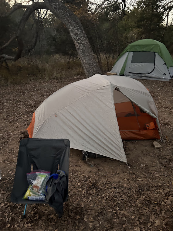
I made the drive out around 11:30am and arrived a couple of hours later to get my permit for my favorite campsite, the River Backpack Area Site 3. This is the only site that has direct river access and a private beach. This will come into play later.
The temperatures were in the 70s and lows only forecast for the 50s. The night after I left, a cold front would come through and drop into the 30s, so my timing was perfect.


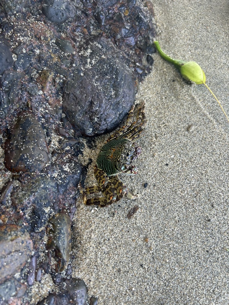
I hiked from Gorman Falls along the Colorado River through the area I call Amadillo Alley and saw plenty of those as the sun went down and I got to my campsite.


The guilty party would show up a bit after dark (three young guys on their first backpacking trip), but were very apologetic and tore down their tent and moved it up the trail to their correct spot. I got in my tent and was asleep just after hiker midnight around 9pm, despite a curious armadillo that was very interested in my spot and almost stuck his nose under my vestibule at one point. Such funny animals.
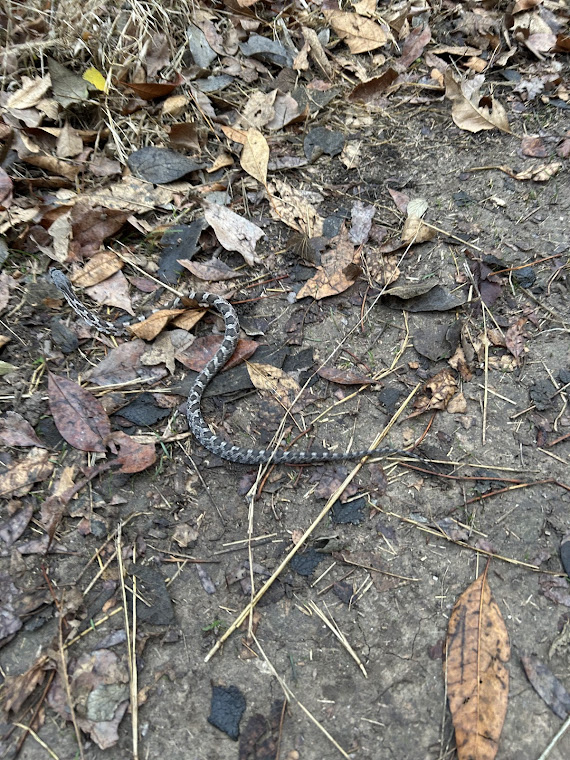
The hike out was very pretty with the sun coming up and I saw plenty of wildlife. A baby rat snake that I helped off the trail:

And a new one for me: a wild boar. Not sure why this video recorded sideways, but I’m including it anyway.
I hiked up Spicewood Canyon, which had some pretty views out over the Colorado River and its tributaries, and then back to the car.
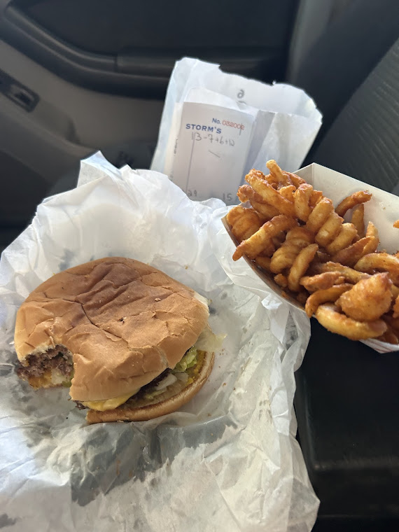
On the way home, I stopped at Storm’s Hamburgers in Lampasas, which is a legendary burger joint. The burger was just ok, but the fries were great. I don’t often eat fast food, but after a long hike, there’s something about it that just hits the spot!
We have a big trip coming up to New Zealand in a few weeks that I will blog in February. This was rescheduled from last year and we are very excited!
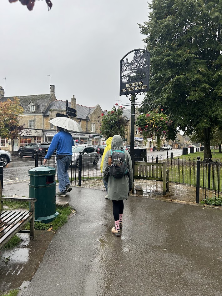
Cotswolds Day 6 – Bourton-on-the-Water Loop 9/25/24
Wednesday, September 25, 2024
10 miles
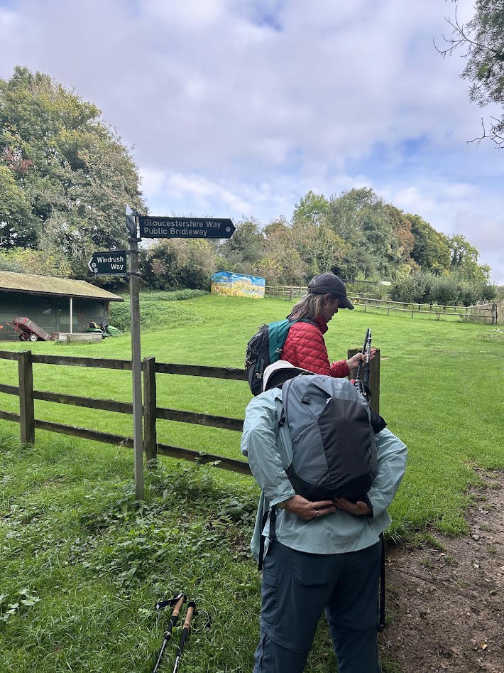
This last day had two route options. We could walk all the way from Bourton-on-the-Water back to where we started this trip at Cheltenham, which would clock in at 17.5 miles. The other option, which we chose, was a 10 mile route over to the town of Naunton and then looping back to Bourton-on-the-Water, where we would meet back up with Dad and drive back to Cheltenham.
This would end up being a good choice, as we got some fairly heavy rain later in the day. Mom joined us for the 4 mile hike to Naunton, where Dad was meeting us for lunch. He would then take her back and Court and I would finish the journey back on foot.
The walk out of Bourton-on-the-Water brought us through some quaint country cottages before diving into the woods for a bit.


We came out of the woods and hiked through a valley of horse and sheep pastures. Court got to touch one of the horses and then Mom lost her trekking poles trying to get a picture.
We met Dad in Naunton at the Black Horse Inn for lunch and he and Mom would head back in the car. Once we bid them farewell, Court and I headed up the hill behind Naunton to loop back to the beginning. Then it started to rain.


Luckily, a lot of the rest of the hike was sheltered under forest canopy, so it wasn’t too bad.

The last part of this day was the same trail that we had followed the day before from Lower Slaughter back to Bourton-on-the-Water. We did stop for a pint at a pub in Lower Slaughter while we waited out the rain a bit.

When we arrived back at Bourton-on-the-Water we packed up and headed to Cheltenham to spend our last night before heading to London for three days. We were treated to a nice sunset.


We would head back to London the next day on the same train that brought us out to the Cotswolds. This was a beautiful and unique trip that we all enjoyed very much. Thanks to Mom for the inspiration and ultimately putting together all the logistics. I’m glad I got to experience this with you and Dad and my wife. I will look back on it fondly, always.
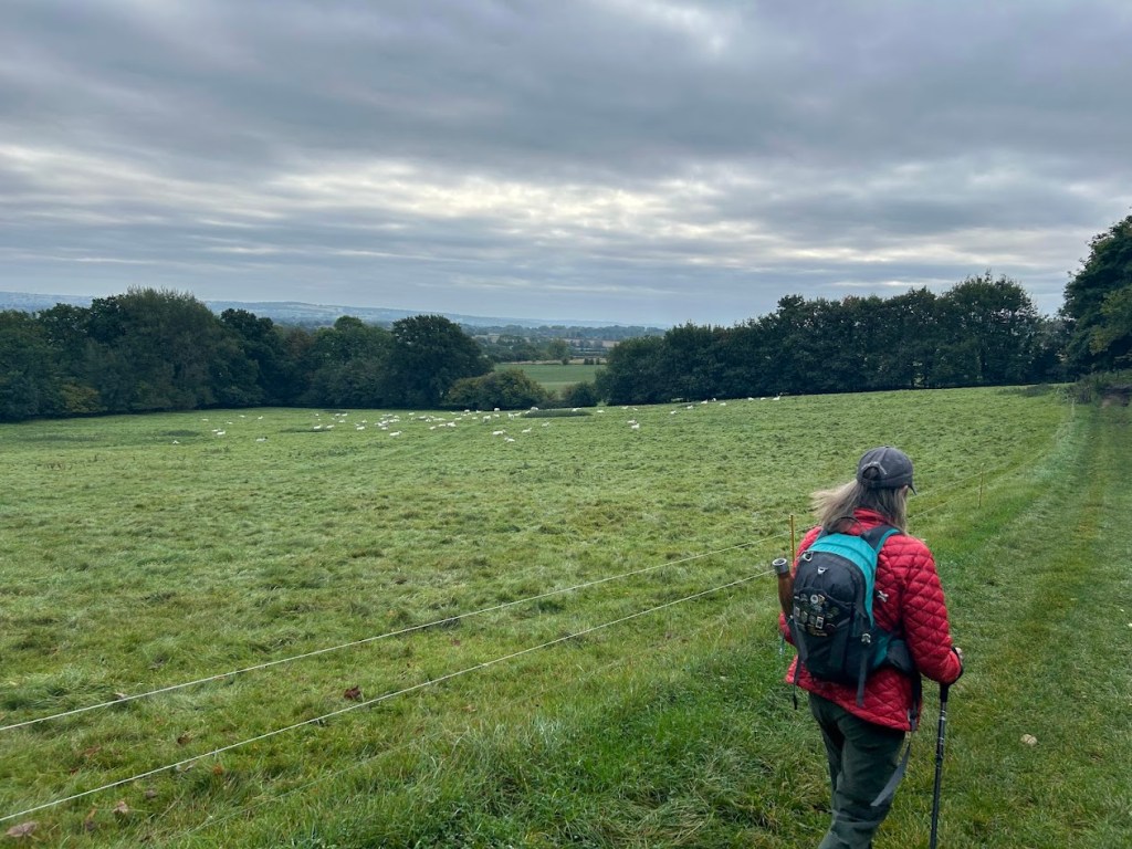
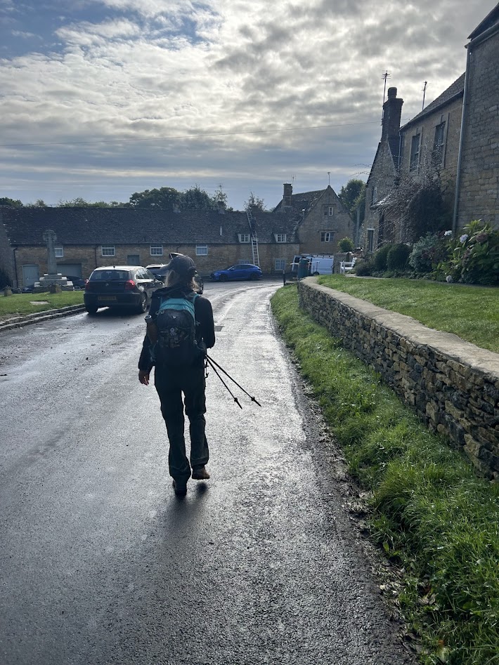
Cotswolds Day 5 – Moreton-In-Marsh to Bourton-on-the-Water 9/24/24
Tuesday, September 24, 2024
12 miles
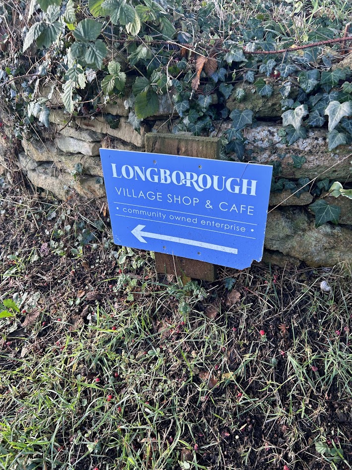
Back on trail! Mom would meet us a few miles in at Stow-on-the-Wold. Court and I set out across the pastures on a chilly and cloudy, but not rainy, morning. This is the longest day of hiking and thus, the longest blog entry for this trip.


After a couple of hours the clouds parted and we got some blue skies!
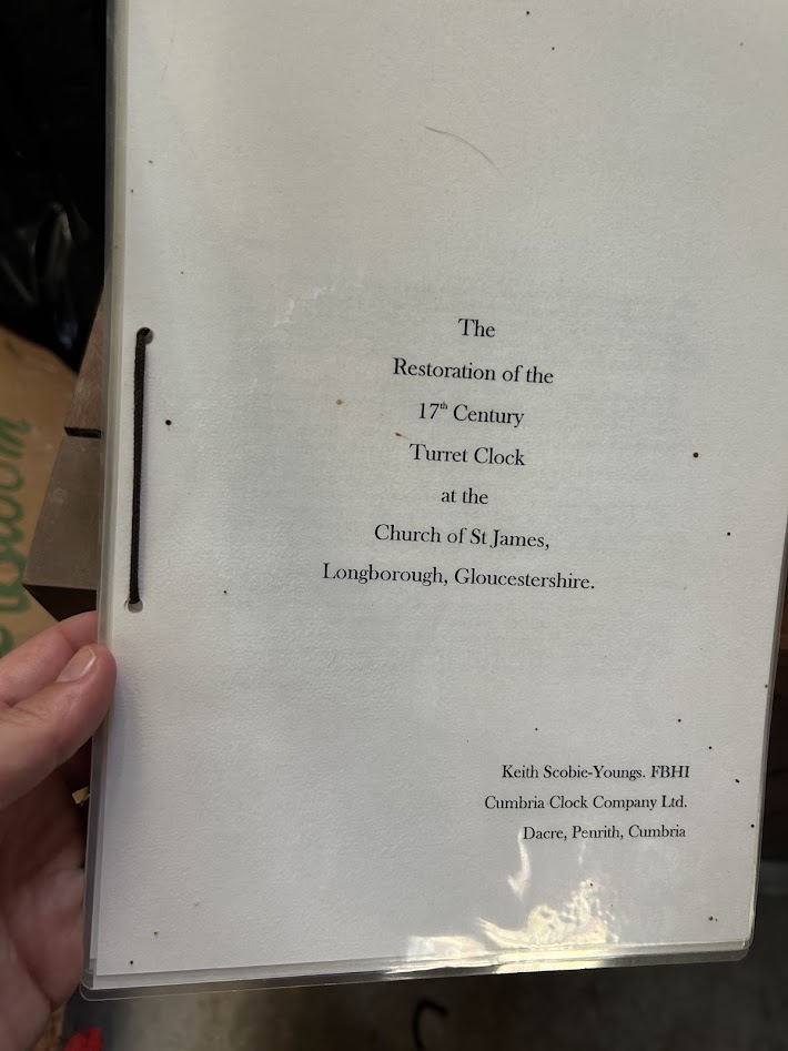
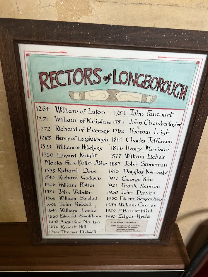
The first village we came to was Longborough and also one of Courtney’s favorites. This had one of the oldest churches on this trip, dating back to 1264. We went inside and there were two caretakers cleaning it who were very nice and seemed pleased we decided to stop in.


They also had a clock from the 1600s that had been restored. It was just the inner workings and a pendulum.


We made a quick stop for a snack at the town co-op, which was very cute. This town probably only had about 200 people or so. We then headed on to Stow-on-the-Wold.


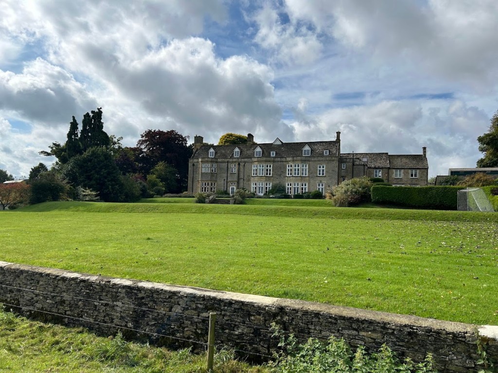
A few more fields, a huge manor home, and then Court of course had to stop at the swings.


Stow-on-the-Wold was crowded, but nice, and we could certainly have spent some more time there if we didn’t have more miles to make. We met Mom and Dad for lunch and then Mom joined us for the rest of the day.

This is also the home of the famous Tolkien Door:

From the Stow and District Civic Society:
“St. Edward’s Church, Stow-on-the-Wold, in Gloucestershire, was built on the site of a former Saxon church and the present-day edifice fuses various architectural styles. Whilst all of its authentic features are of interest in their own right, there is one feature that has become the most photographed door in the Cotswolds. The church’s north door, flanked by two ancient yew trees is rumoured to have sparked J. R. R. Tolkien’s inspiration for the “Doors of Durin,” the west gate of Moria that appears in a scene in the The Lord of the Rings: The Fellowship of the Ring.”
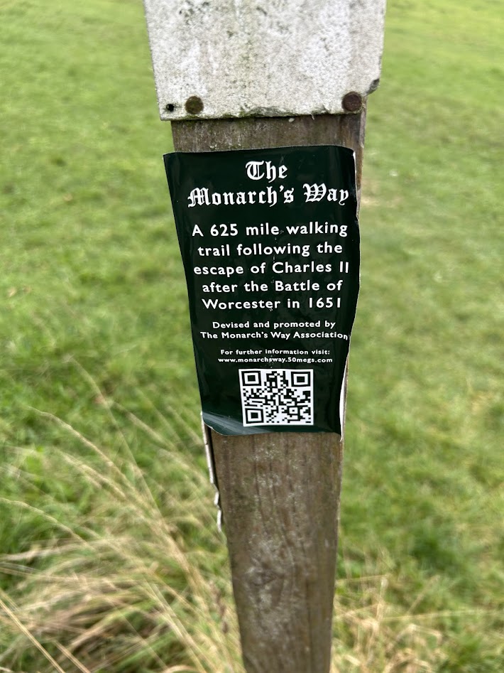
We set off along The Monarch’s Way, which is supposedly the path that King Charles II used to escape in 1651 after being defeated in the Battle of Worcester. The whole path is 625 miles long. More green fields and large manors on this route.


The last town before our destination was Lower Slaughter. Pretty town.


We hiked into Bourton-on-the-Water a mile or so later through some back road neighborhoods, which honestly felt a bit sketchy, but the main town center was lovely. There’s a small river (creek?) that flows through town with several bridges and it’s only about 10 inches deep the entire way, so it feels very quaint and picturesque.

After a pint and dinner, we retired to our hotel rooms for a good rest. Tomorrow would be our last day of hiking.
Cotswolds Day 4 – Rain Day! Stratford-Upon-Avon 9/23/24
Monday, September 24, 2024
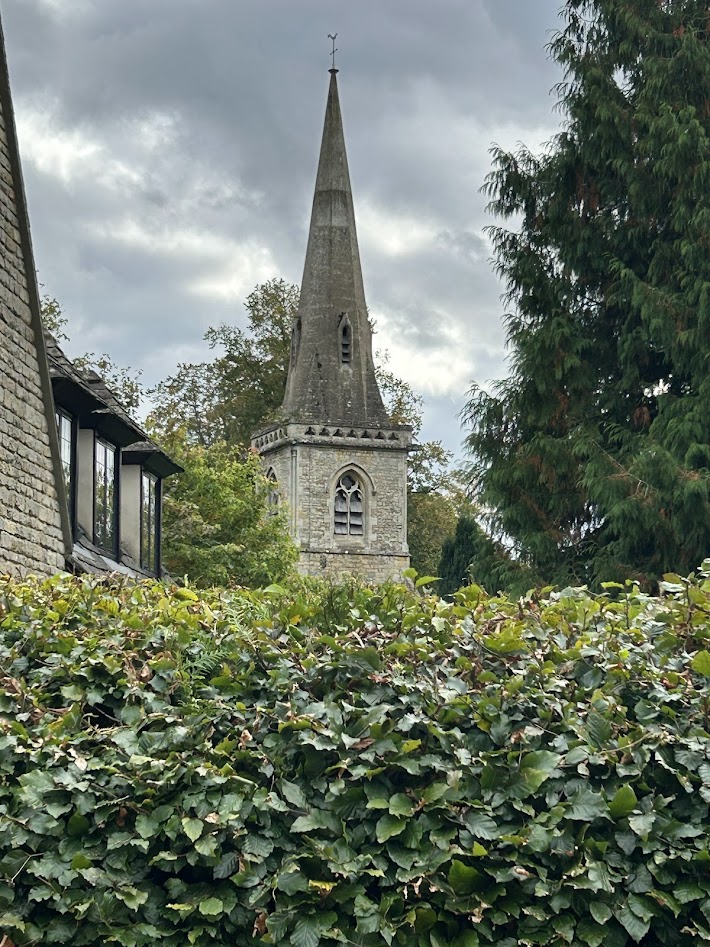
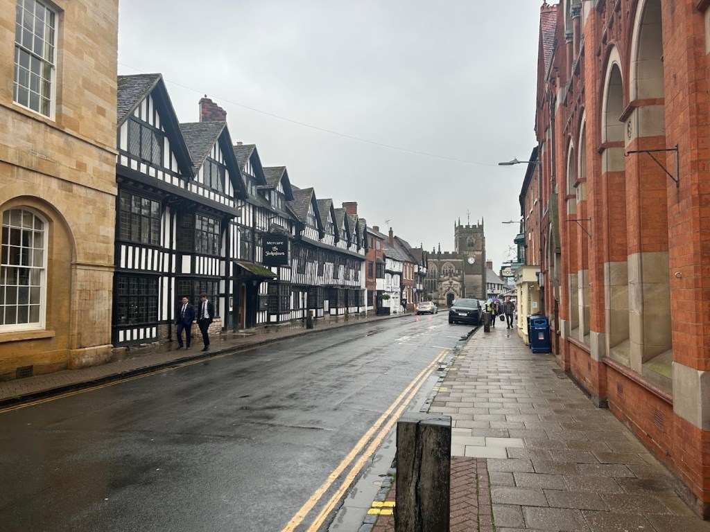
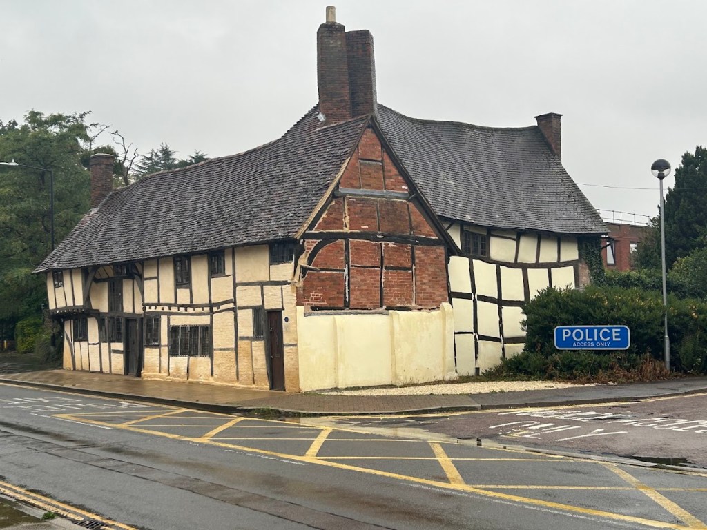
Today was rainy all day long, so we all decided to skip the hiking section from Chipping Campden to Moreton-in-Marsh (7.75 miles) and instead drive a half hour up to Stratford-Upon-Avon, the birth and death-place of William Shakespeare. The town is beautiful, if a bit touristy, but my favorite part was the Holy Trinity Church where he is buried.

We walked around town in the rain, but it wasn’t too heavy most of the time.


The Avon River runs through town and we walked along it until we got to the church.


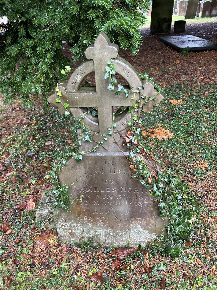
The church had a great graveyard and we looked for the oldest headstone for a bit. I think the oldest we found was around 1780.
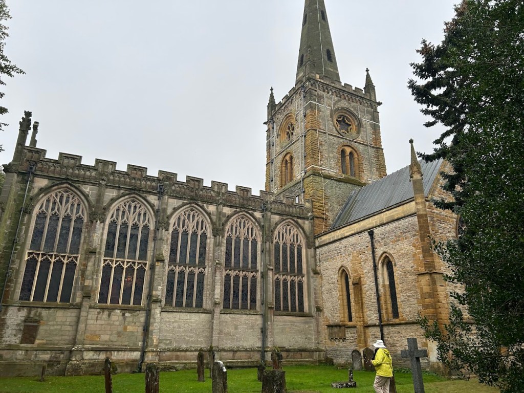


Shakespeare is interred inside. There were several people explaining the history and points of interest. One man had memorized a newly discovered Tolkien poem about Christmas and recited it to us. Random, but I’m always down for anything Tolkien related.


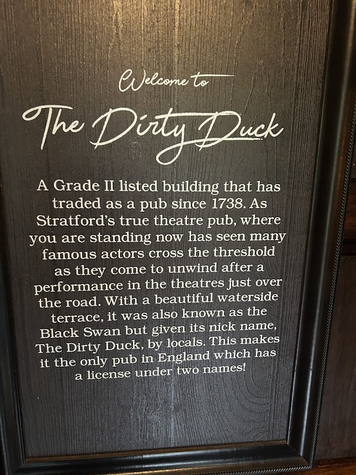
After the church, we went to eat lunch at the Black Swan Pub, which also is called The Dirty Duck by the locals. It’s a place where the Shakespearean actors in the town gather to imbibe and there’s a separate wing of the bar where they hang out. It was a cool vibe.


We then walked back through town to our car and headed to Moreton-in-Marsh, where we would stay for the night and get ready to hike again the next day, when the weather was supposed to clear up a bit.

Recent Comments